Summary
Learning how to Track Snowfall Accumulation in Real Time helps you make smarter decisions during winter weather, whether you are planning a school day, checking commute safety, monitoring a storm, or preparing for snow removal. Real-time snowfall tracking combines weather radar, satellite imagery, snow-depth sensors, official storm reports, forecast models, and local measurements to show how much snow has already fallen, how fast it is accumulating, and how much more may arrive. This guide explains the best tools, data sources, methods, and practical tips for monitoring snowfall accurately as conditions change.
Table of Content
- What Does Real-Time Snowfall Accumulation Mean?
- Why You Should Track Snowfall Accumulation in Real Time
- Best Tools to Track Snowfall Accumulation in Real Time
- How Weather Radar Helps Track Snowfall Accumulation in Real Time
- Using Official Snow Reports and Weather Stations
- How to Measure Snowfall at Home Accurately
- Understanding Snow Depth vs. Snowfall Accumulation
- How Forecast Models Estimate Snow Totals
- Real-Time Snow Tracking for School Closings and Snow Days
- Common Mistakes When Tracking Snowfall
- Conclusion
- FAQs
What Does Real-Time Snowfall Accumulation Mean?
Real-time snowfall accumulation refers to the process of monitoring snow totals as they develop during an active winter storm. Instead of waiting until the storm ends, real-time tracking shows how much snow has fallen over the past few minutes, hours, or day. It can also help estimate how fast snow is accumulating on roads, driveways, lawns, rooftops, and open surfaces.
Snow accumulation depends on several weather factors. Air temperature, ground temperature, snow-to-liquid ratio, wind speed, elevation, storm track, and precipitation intensity all affect how much snow actually stays on the ground. A storm may produce heavy snowfall in the atmosphere, but if the surface is warm or the snow is wet, the accumulation may be lower than expected.
For example, a location may receive one inch of liquid precipitation. If the air is cold and the snow is fluffy, that could produce 10 to 15 inches of snow. If temperatures are near freezing and the snow is wet, the same amount of liquid may create only 4 to 6 inches. That is why real-time snowfall tracking is more useful than relying only on a general forecast.
When you track snowfall in real time, you are looking at both observed data and short-term weather updates. Observed data includes radar, snow gauges, airport observations, trained weather spotter reports, and local measurements. Forecast updates include high-resolution weather models, nowcasting tools, and alerts from meteorological agencies.
Why You Should Track Snowfall Accumulation in Real Time
There are many practical reasons to monitor snowfall as it happens. Snow can change plans quickly, especially during fast-moving winter storms, lake-effect snow events, nor’easters, mountain snowstorms, and freezing rain transitions.
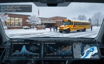
For families, real-time snow tracking helps determine whether school delays or closures are likely. If you are watching snow totals build during the evening or overnight, you can better estimate whether roads may be unsafe the next morning. You can also use tools like the Free Snow Day Calculator to combine snowfall expectations with school-closing probability.
For commuters, knowing the current snow accumulation can help you decide whether to leave early, work from home, delay travel, or choose a safer route. Two inches of snow during rush hour can create more problems than six inches overnight if road crews have time to treat and plow surfaces.
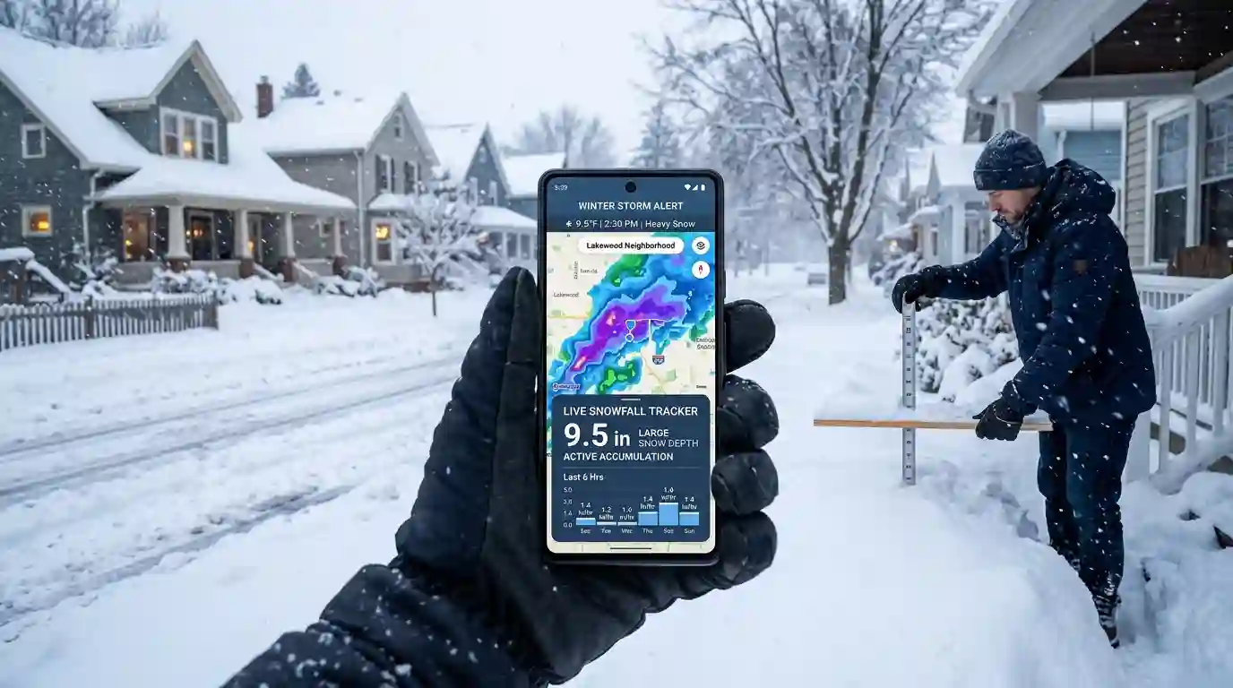
For homeowners, real-time tracking helps with snow removal planning. If snow is falling at one inch per hour, shoveling or snow blowing during the storm may be better than waiting until the end. Heavy wet snow can become difficult to remove and may increase stress on roofs, tree limbs, and power lines.
For weather enthusiasts, tracking snow accumulation is also a way to understand storm behavior. You can compare radar returns, weather maps, forecast models, and actual ground reports to see how accurate predictions are. To improve your winter-weather reading skills, check out How to Read a Weather Map for Snow Day Clues.
Best Tools to Track Snowfall Accumulation in Real Time
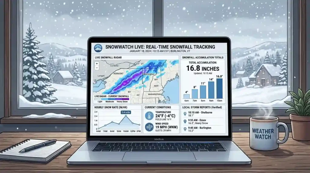
There is no single perfect tool for snow tracking. The best approach is to combine several sources. Each tool gives a different piece of the storm picture.
Weather Radar
Weather radar is one of the fastest ways to see where snow is falling right now. Radar detects precipitation in the atmosphere and shows intensity, movement, and storm structure. Many weather apps display radar loops that update every few minutes.
However, radar does not directly measure snow on the ground. It estimates precipitation in the air. Snow may evaporate before reaching the surface, melt into rain, or accumulate differently depending on temperature. Radar is excellent for tracking storm movement, but it should be compared with surface observations.
Official Snow Analysis Maps
Official snow analysis maps are among the most reliable sources for broader snowfall data. In the United States, NOAA’s National Operational Hydrologic Remote Sensing Center provides national snow analysis tools and snowfall-related datasets. You can use the official NOAA National Snow Analyses page as an authoritative external resource for snow depth, snow water equivalent, snowpack, and regional snow conditions.
These maps are especially helpful when you want to compare your local snowfall with surrounding towns, counties, or mountain regions.
Local Weather Stations
Weather stations provide temperature, wind, humidity, pressure, and sometimes precipitation data. Some stations are professional-grade, while others are personal weather stations installed by homeowners, schools, farms, or local agencies.
A nearby weather station can help confirm whether snow is likely to accumulate. If the air temperature is 28°F and the dew point is low, snow may accumulate quickly. If the temperature is 34°F with warm pavement, the first few hours of snow may melt on contact.
Snow Depth Sensors
Snow depth sensors use ultrasonic or laser technology to measure the distance between the sensor and the snow surface. These are commonly used at ski resorts, mountain passes, avalanche centers, research sites, and hydrology stations.
Snow depth sensors are valuable because they show how snowpack changes over time. They can help detect new snowfall, settling, melting, and compaction. However, they may not always represent nearby neighborhoods because snow varies by elevation, wind exposure, and terrain.
Weather Apps and Alerts
Modern weather apps often combine radar, forecast models, alerts, and user reports. Apps can be useful for quick checks, but they vary in accuracy. Some rely heavily on automated model data, while others use meteorologist-reviewed forecasts.
When using weather apps, compare several sources instead of trusting one number. If one app predicts 2 inches and another predicts 8 inches, look deeper into radar trends, temperature profiles, and official forecasts.
How Weather Radar Helps Track Snowfall Accumulation in Real Time
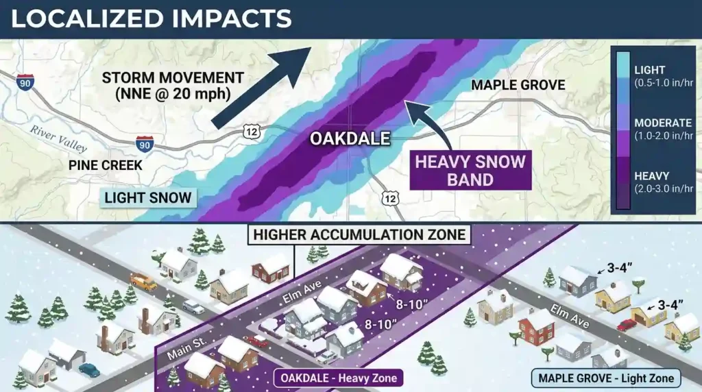
Radar is one of the most important tools for real-time snow monitoring because it shows precipitation location and intensity. A radar loop can reveal whether a snow band is moving toward your area, weakening, strengthening, or stalling.
Interpreting Radar Colors During Snow
Radar colors usually represent precipitation intensity. Light blues and greens often indicate lighter precipitation, while darker colors may show heavier snow. However, radar color scales differ by app and region. A darker radar return does not always mean heavy snow at the surface.
In winter storms, bright radar bands can form where snowflakes are large or melting. This is sometimes called bright banding. It may make precipitation appear heavier than it really is. That is why radar should be paired with ground observations.
Watching Snow Bands
Snow bands are narrow zones of heavier snowfall. They can produce rapid accumulation over one town while nearby areas receive much less. Lake-effect snow is a classic example. One neighborhood may receive 12 inches while another location 10 miles away gets only 2 inches.
If you want to track snowfall accumulation in real time, watch whether your location is under a persistent snow band. Snowfall rates of 1 to 3 inches per hour can occur in intense bands, quickly changing road conditions and school-closing potential.
Checking Radar Movement
Radar loops show storm direction and speed. If snow is moving quickly, accumulation may be limited. If the radar shows training bands, where snow repeatedly moves over the same area, totals can increase rapidly.
Using Official Snow Reports and Weather Stations
Official reports help confirm what is actually happening on the ground. These reports may come from airports, trained spotters, cooperative observers, emergency management agencies, road departments, ski areas, and public weather networks.
National Weather Service Reports
The National Weather Service often collects storm reports from trained spotters and local agencies. These reports may include snowfall totals, snow depth, ice accumulation, wind gusts, visibility, and storm damage.
Official reports are useful because they are usually quality-controlled. However, they may not update every minute. During a major storm, reports may come in at irregular intervals.
Airport Weather Observations
Airports issue routine weather observations that include temperature, wind, visibility, precipitation type, and cloud conditions. Some airport reports also include snow information. Airport data is highly reliable, but it may not match your backyard if you live far from the airport or at a different elevation.
Road and Transportation Cameras
Traffic cameras, road sensors, and department of transportation updates can help you understand real-world snow impact. Even if snowfall totals are modest, roads may become dangerous if snow falls heavily during peak travel times or temperatures drop below freezing.
How to Measure Snowfall at Home Accurately
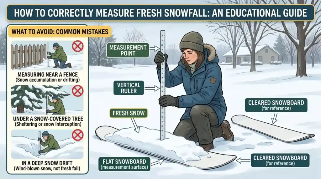
If you want the most local answer, measuring snow yourself is one of the best methods. A simple ruler and a flat surface can provide useful snowfall data.
Choose the Right Measuring Surface
Use a flat, level surface away from buildings, trees, fences, and drifting areas. A snowboard, wooden board, patio table, or open grassy area can work well. Avoid measuring on pavement if the ground is warm, because snow may melt from below.
Measure in Multiple Spots
Snow rarely falls evenly. Wind can create drifts, while trees and buildings can block snow. Take measurements in several nearby spots and average them. Avoid unusually high drifts or bare patches.
Clear the Board During Long Storms
For long-duration storms, snow can compact under its own weight. If you measure only at the end, you may undercount total snowfall. Many weather observers clear their snowboard every six hours during an ongoing storm, then add the measurements together.
Record Time and Conditions
Write down the time, snow depth, temperature, precipitation type, wind conditions, and any changes from snow to sleet or rain. This makes your snowfall log more useful and accurate.
Understanding Snow Depth vs. Snowfall Accumulation
Snow depth and snowfall accumulation are related, but they are not the same.
Snowfall accumulation is the amount of new snow that has fallen during a specific period. For example, a storm may produce 8 inches of new snow.
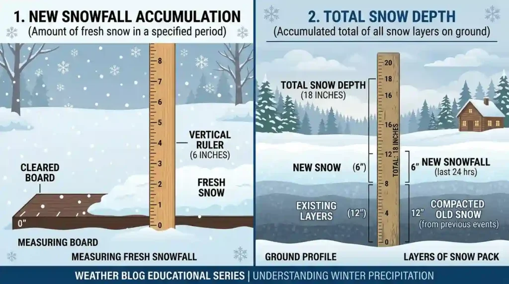
Snow depth is the total amount of snow currently on the ground. If there were already 4 inches of old snow and a storm adds 8 inches, the snow depth may become 12 inches. But because of melting, compaction, wind, and settling, the final snow depth may be less.
Why the Difference Matters
This difference is important for school closings, travel safety, skiing, hydrology, and snow removal. Fresh snowfall affects roads and visibility. Snow depth affects snowpack, flooding potential, roof load, and winter recreation.
Snow Water Equivalent
Snow water equivalent, often called SWE, measures how much water is contained in the snowpack. This is especially important for flood forecasting, reservoir planning, agriculture, and mountain snowpack monitoring.
Light fluffy snow has less water content. Heavy wet snow has more water content. That is why 10 inches of powder may be easier to shovel than 4 inches of dense wet snow.
How Forecast Models Estimate Snow Totals
Forecast models use atmospheric data to predict precipitation type, temperature, storm track, moisture, lift, and snowfall amounts. These models help meteorologists estimate where snow will fall and how much may accumulate.
Short-Range Models
Short-range models are useful during active storms because they update frequently and focus on the next few hours to couple of days. They can help identify shifting snow bands, rain-snow lines, and local accumulation differences.
Snow-to-Liquid Ratio
One of the hardest parts of snow forecasting is estimating the snow-to-liquid ratio. A common rule of thumb is 10 inches of snow for 1 inch of liquid precipitation, but actual ratios vary widely. Cold, dry air may create 15:1 or 20:1 snow. Warmer storms may produce 5:1 or 8:1 snow.
Ground Temperature
Even if snow is falling, accumulation may be limited when ground temperatures are above freezing. Early-season storms often struggle to accumulate on roads, sidewalks, and driveways. Grass and elevated surfaces may accumulate first.
Real-Time Snow Tracking for School Closings and Snow Days
Real-time snowfall tracking is especially helpful for predicting school closures. School administrators often consider more than just snowfall totals. They look at road safety, timing, bus routes, ice risk, visibility, wind chills, and whether crews can clear roads before morning.
Evening Snowfall
If snow begins in the evening and continues overnight, school closure chances may rise because roads can become snow-covered before buses start running.
Morning Snowfall
If the heaviest snow arrives during the morning commute, even lower totals can create dangerous travel conditions. A fast burst of snow at 6 a.m. may have more impact than light snow falling after school starts.
Ice and Mixed Precipitation
Snow is not the only concern. Sleet and freezing rain can create hazardous roads with less visible accumulation. When tracking a winter storm, always check precipitation type and temperature trends.
Common Mistakes When Tracking Snowfall
Even experienced weather watchers can misread snow data. Avoid these common mistakes.
Trusting One Weather App
One app may show a simple snow total, but it may not explain uncertainty. Always compare radar, official forecasts, local observations, and updated storm reports.
Confusing Snow Depth With New Snowfall
A report of 10 inches on the ground does not always mean 10 inches fell today. It may include old snowpack from previous storms.
Measuring in Drifts
Wind can pile snow into deep drifts that exaggerate snowfall totals. Measure in open, representative areas.
Ignoring Temperature
Temperature affects whether snow accumulates, melts, compacts, or changes to rain. Always track air temperature, ground temperature, and precipitation type.
Forgetting About Elevation
Snowfall can change dramatically with elevation. A valley may receive rain while nearby hills receive several inches of snow. Mountain regions require extra attention to elevation-based forecasts.
Conclusion
Knowing how to track snowfall accumulation in real time gives you a major advantage during winter storms. Instead of relying only on a forecast made hours earlier, you can watch radar, compare official snow reports, check weather stations, measure snow at home, and monitor changing temperatures. This helps you make safer and smarter decisions about school, travel, snow removal, and winter planning.
The most accurate approach is to combine multiple sources. Radar shows where snow is falling now. Official maps show regional snow conditions. Weather stations reveal temperature and wind trends. Local measurements confirm what is happening in your own yard. When these tools are used together, you get a much clearer picture of real-time snowfall accumulation.
Whether you are hoping for a snow day, preparing for a commute, or simply tracking a winter storm, real-time snow monitoring helps turn confusing weather data into practical decisions.
FAQs
1. What is the best way to track snowfall accumulation in real time?
The best way is to combine radar, official snow reports, local weather stations, snow depth maps, and your own measurements. Radar shows where snow is falling, while ground reports confirm how much snow has actually accumulated.
2. Can radar measure exact snowfall totals?
Radar can estimate precipitation intensity, but it does not directly measure snow on the ground. Snowfall totals depend on temperature, snow ratio, melting, compaction, and local conditions. Always compare radar with official reports and ground measurements.
3. How often should I measure snow during a storm?
For long storms, measuring every six hours can improve accuracy because snow settles and compacts over time. For casual tracking, measuring every few hours during heavy snow is usually enough.
4. Why does my snowfall total differ from the official report?
Snowfall can vary across short distances due to elevation, wind, snow bands, trees, buildings, and measurement methods. Your yard may receive more or less snow than the nearest official station.
5. What is the difference between snow depth and snowfall accumulation?
Snowfall accumulation is the amount of new snow that falls during a specific time period. Snow depth is the total amount of snow currently on the ground, including old snow, new snow, and compacted layers.
6. How can I tell if snow will accumulate on roads?
Check air temperature, pavement temperature, snowfall rate, and time of day. Snow accumulates more easily when temperatures are below freezing and snowfall rates are moderate to heavy.
7. Why does wet snow accumulate differently than dry snow?
Wet snow contains more water and is denser, so it compacts quickly. Dry snow is fluffier and can pile up faster, especially in colder temperatures.
8. Can I use snowfall tracking to predict school closings?
Yes. Real-time snow totals, storm timing, road conditions, and temperature trends can help estimate school-closing chances. However, each school district makes decisions based on local safety conditions.
9. What does snowfall rate mean?
Snowfall rate is how quickly snow is accumulating, usually measured in inches per hour. A rate of 1 inch per hour or more can quickly make roads hazardous.
10. Are official snow maps always real time?
Some official snow maps update frequently, while others may lag depending on data collection and quality control. Use them with radar and local reports for the best real-time understanding.