Summary
When winter weather strikes, parents and students immediately think about how many inches of snow have fallen. But school administrators know that wind chill matters more than snowfall for school closures when it comes to keeping students safe. Wind chill—the combination of cold air temperature and wind speed—can turn a mild winter morning into a dangerous situation within minutes, especially for kids waiting at bus stops or walking to school. While snowfall affects road conditions and visibility, wind chill directly threatens human safety through frostbite and hypothenia risks. This article explores why school districts increasingly prioritize wind chill data over snow accumulation totals, how meteorological factors interact to create closure decisions, and what parents should understand about the science behind a “snow day.”
Table of Contents
- Understanding Wind Chill vs. Snowfall: What’s the Real Difference?
- The Hidden Dangers of Wind Chill for Students
- How Wind Chill Matters More Than Snowfall for School Closures: The Decision-Making Process
- Frostbite, Hypothermia, and the 30-Minute Rule
- Why Snowfall Alone Doesn’t Tell the Whole Story
- Regional Variations in Wind Chill Thresholds
- Bus Stop Safety and Wind Exposure
- The Role of Technology in Predicting Closures
- How Parents Can Prepare for Wind Chill Days
- Conclusion
- FAQs
Understanding Wind Chill vs. Snowfall: What’s the Real Difference?
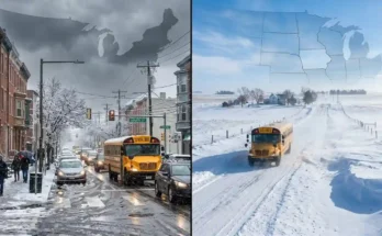
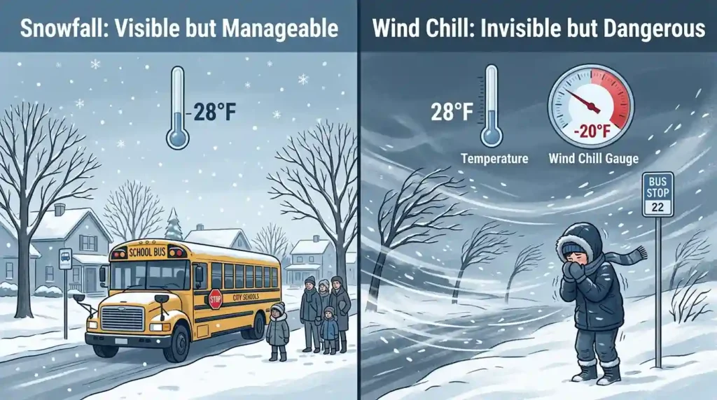
Snowfall and wind chill are two completely different meteorological measurements, yet they’re often confused by the general public. Snowfall refers to the accumulation of frozen precipitation on the ground, measured in inches or centimeters. It primarily affects road conditions, plowing schedules, and visibility for drivers and pedestrians.
Wind chill, on the other hand, is a calculated value that represents how cold the air feels on exposed skin when wind speed is factored into the actual air temperature. The National Weather Service (NWS) uses a specific formula combining wind speed and ambient temperature to produce a wind chill index value. A day with just an inch of snow but a wind chill of -25°F can be far more dangerous than a day with eight inches of snow and calm winds.
Why This Distinction Matters for School Districts
School superintendents and transportation directors must weigh multiple risk factors when deciding whether to call a snow day, a delayed start, or a full closure. While heavy snowfall can make roads impassable for buses, extreme wind chill creates an entirely different category of risk—one that affects children the moment they step outside, regardless of road conditions.
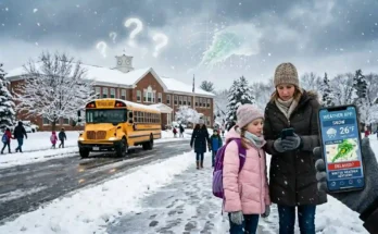
The Hidden Dangers of Wind Chill for Students
Unlike snow accumulation, which is visible and predictable, wind chill is an invisible threat. A student might look out the window, see only a light dusting of snow, and assume it’s a normal school day. However, if wind speeds are gusting at 25-30 mph and the actual temperature is in the single digits, the wind chill could plunge to dangerously low levels—sometimes below -15°F or even -30°F in northern states.
Exposed Skin and Wind Chill Risk
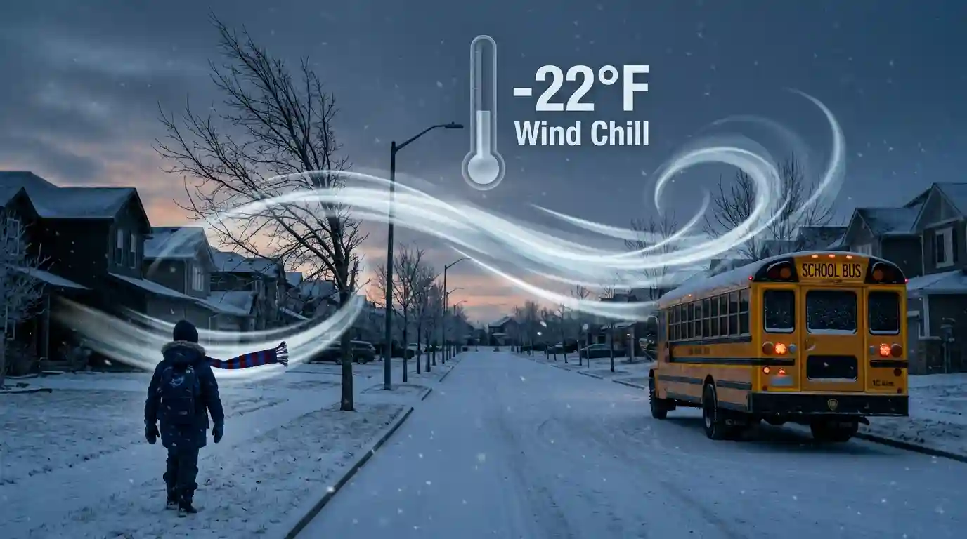
The primary concern with wind chill is exposed skin. Even well-insulated children wearing hats, gloves, and scarves can experience frostbite on cheeks, noses, and ears within 10 to 30 minutes when wind chill values drop below -18°F (-28°C). This is why many school districts have established specific wind chill thresholds that automatically trigger closures or delays, separate from any snowfall totals.
Respiratory Concerns
Extreme cold combined with wind exposure can also exacerbate respiratory conditions like asthma, which is common among school-age children. Cold, dry air constricts airways, and when wind chill amplifies the perceived cold, even a short walk to the bus stop can trigger breathing difficulties for vulnerable students.
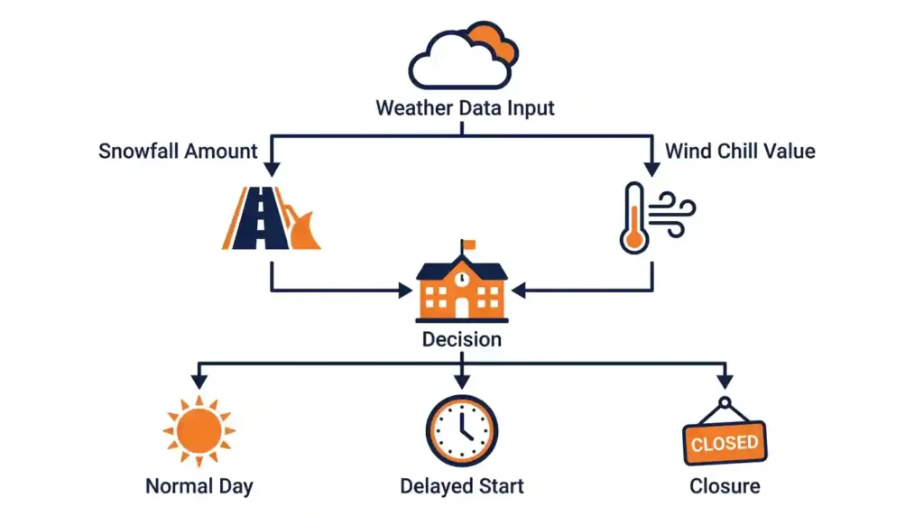
How Wind Chill Matters More Than Snowfall for School Closures: The Decision-Making Process
School districts typically rely on a combination of data sources, including the National Weather Service, local meteorologists, and district-specific transportation assessments. However, when wind chill matters more than snowfall for school closures, it’s often because of a specific decision-making hierarchy that prioritizes immediate human safety risks over logistical challenges.
Step 1: Checking Overnight and Early Morning Wind Chill Forecasts
Most decisions are made between 4:00 AM and 5:30 AM, based on real-time and forecasted wind chill values for the time when students would be walking to bus stops or schools (typically 6:00-8:00 AM).
Step 2: Comparing Against District-Specific Thresholds
Many districts in colder climates have established wind chill thresholds—often around -15°F to -25°F—that trigger automatic closures regardless of how much snow has fallen. Some districts use a tiered system:
- Wind chill above 0°F: Normal schedule
- Wind chill -1°F to -15°F: Delayed start or shortened outdoor time
- Wind chill below -15°F: Full closure or remote learning day
Step 3: Assessing Bus Stop Wait Times
Transportation directors also factor in how long children typically wait outdoors for buses. If average wait times exceed 10-15 minutes in extreme wind chill, the risk of frostbite increases significantly, even if buses themselves can operate safely on the roads.
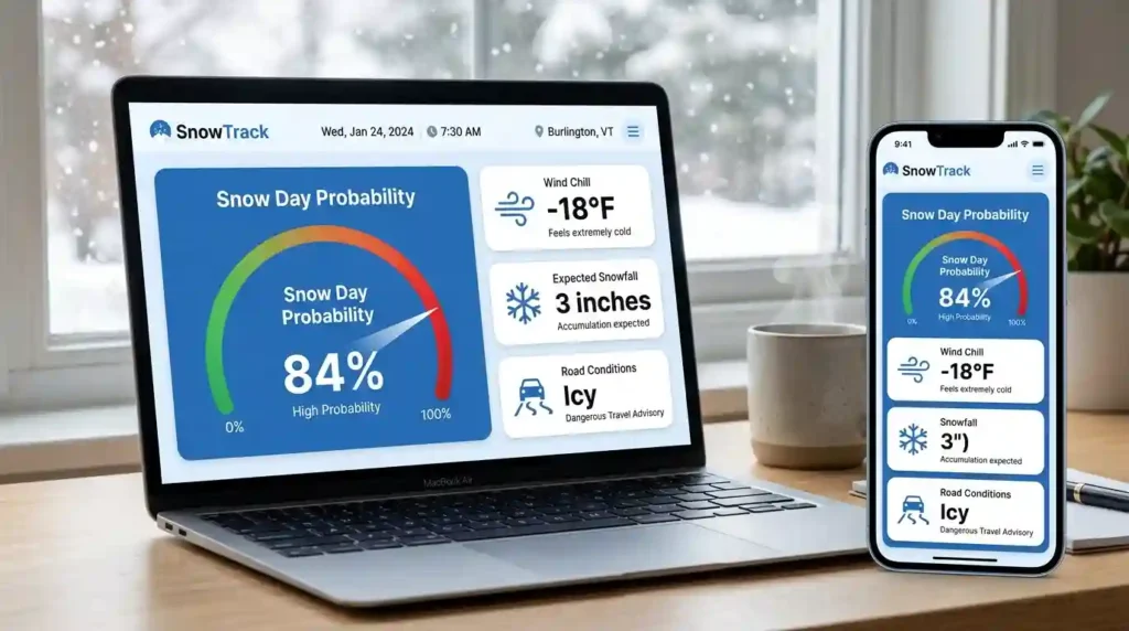
For families wanting to estimate closure probability based on these factors, tools like the Free Snow Day Calculator can provide a helpful preliminary assessment by combining temperature, wind chill, and snowfall data into a single probability score.
Frostbite, Hypothermia, and the 30-Minute Rule
Medical professionals and meteorologists often reference what’s informally called the “30-minute rule” when discussing wind chill safety. According to the Centers for Disease Control and Prevention (CDC), frostbite can occur on exposed skin in as little as 30 minutes when wind chill values reach -19°F, and the risk increases exponentially as temperatures drop further.
Stages of Cold-Related Injury
- Frostnip: Mild, reversible numbness and redness, typically affecting fingers, toes, ears, and nose.
- Frostbite: Tissue damage that can cause permanent injury, requiring medical attention.
- Hypothermia: A drop in core body temperature, which can be life-threatening if untreated.
Children are particularly vulnerable because they have a higher surface-area-to-body-mass ratio than adults, meaning they lose heat faster. This biological factor is a critical reason why school administrators treat wind chill warnings with such seriousness.
For a deeper dive into how specific temperature thresholds influence closure decisions, our related article on Temperature Triggers a Snow Day Decision breaks down the science in greater detail.
Why Snowfall Alone Doesn’t Tell the Whole Story
Many parents assume that more snow automatically means a higher chance of a snow day. While heavy snowfall (typically 6+ inches) does increase the likelihood of closures due to road conditions, it’s not always the deciding factor—especially in regions accustomed to frequent snow.
Cities That Are “Snow-Ready” vs. Wind-Chill Vulnerable
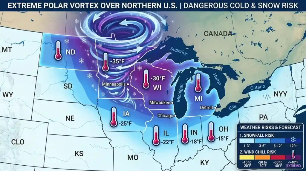
Northern cities like Minneapolis, Buffalo, and Fargo have robust snow removal infrastructure and can often clear roads quickly even after significant snowfall. However, these same regions are highly susceptible to extreme wind chill events, particularly during polar vortex episodes when Arctic air masses combine with strong winds.
In contrast, southern or transitional climate regions (like parts of Texas, Tennessee, or Virginia) may close schools for relatively minor snowfall because they lack the equipment to handle it—but wind chill is rarely the primary concern in these areas since extreme cold events are less frequent.
The Polar Vortex Factor
The polar vortex—a large area of low pressure and cold air surrounding the Earth’s poles—occasionally weakens and sends frigid air southward into the United States. During these events, wind chill values can plummet to historic lows even without significant snowfall, leading to widespread school closures across multiple states purely based on temperature and wind data.
Regional Variations in Wind Chill Thresholds
Not all school districts use the same wind chill thresholds, and this variation often reflects regional climate norms and community expectations.
Northern Climate Districts
In states like Minnesota, North Dakota, and Wisconsin, students are generally acclimated to cold weather, and schools may remain open even when wind chills reach -10°F to -15°F, provided buses are running and indoor recess plans are in place.
Transitional Climate Districts
States like Ohio, Indiana, and Pennsylvania often have lower thresholds, closing schools when wind chill drops below -10°F, partly because infrastructure and community preparedness for extreme cold is less consistent.
Southern Climate Districts
In states unaccustomed to sub-zero temperatures, even a wind chill of 10°F to 15°F combined with light snow can prompt closures, as both students and infrastructure are less prepared for cold weather conditions.
Bus Stop Safety and Wind Exposure
One of the most overlooked factors in school closure decisions is the physical environment of bus stops themselves. Open fields, rural roads, and areas without windbreaks expose children to far higher wind speeds than urban or suburban areas with buildings and trees that block wind.
Rural vs. Urban Wind Exposure
Rural students often face longer bus routes and more exposed waiting areas, meaning the effective wind chill they experience can be significantly higher than the wind chill reported for a nearby city center. This is why some districts make different decisions for rural bus routes versus in-town schools, sometimes implementing partial closures or remote learning specifically for rural students.
The Role of Technology in Predicting Closures
Modern school districts increasingly rely on hyperlocal weather data, real-time wind chill monitoring, and predictive modeling to make closure decisions earlier and more accurately. Apps and online tools that aggregate National Weather Service data, local sensor networks, and historical closure patterns help administrators—and parents—anticipate decisions before they’re officially announced.
These tools analyze multiple data points simultaneously: current temperature, forecasted wind speed, snowfall accumulation rates, road temperature, and even humidity levels (which affect how snow and ice form on roads).
How Parents Can Prepare for Wind Chill Days
Even when schools remain open during cold wind chill conditions, parents can take proactive steps to protect their children:
- Dress children in layers, with a windproof outer layer covering insulating layers underneath
- Ensure ears, nose, and fingers are fully covered with hats, scarves, and mittens (not just gloves)
- Limit outdoor wait time by driving children to bus stops or arranging carpools during extreme cold
- Keep emergency winter kits in vehicles, including blankets, hand warmers, and extra clothing
- Monitor local news and district communication channels for last-minute delay or closure announcements
Conclusion
While snowfall remains a visible and often dramatic indicator of winter weather, wind chill matters more than snowfall for school closures because it directly correlates with immediate physical danger to students. Frostbite and hypothermia risks from extreme wind chill can develop in mere minutes, regardless of how much snow has accumulated on the ground. School districts across the country increasingly recognize this distinction, establishing wind chill-specific thresholds that often override snowfall-based decisions entirely. Understanding this relationship helps parents better interpret weather forecasts, anticipate school closure announcements, and most importantly, keep their children safe during the harshest winter conditions. As climate patterns continue to produce more frequent extreme cold events, the role of wind chill in school safety planning will only become more significant.
FAQs
1. What wind chill temperature typically closes schools?
Most districts use thresholds between -15°F and -25°F, though this varies significantly based on regional climate norms and student acclimation to cold weather.
2. Can schools close due to wind chill even with no snow on the ground?
Yes. Extreme wind chill events, particularly during polar vortex conditions, can trigger closures purely based on temperature and wind speed, independent of snowfall.
3. How long does it take to get frostbite in extreme wind chill?
According to the CDC, frostbite can occur on exposed skin in as little as 30 minutes when wind chill values reach approximately -19°F or lower.
4. Why do rural schools sometimes close while urban schools in the same area stay open?
Rural bus stops often have less protection from wind (no buildings or trees), resulting in higher effective wind chill exposure for students compared to sheltered urban areas.
5. Is there a tool to predict snow day probability based on wind chill and snowfall?
Yes, online calculators that combine temperature, wind chill, and snowfall data can provide a probability estimate—though official decisions always come from local school districts.