Summary
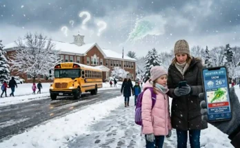
East Coast Snow Days vs Midwest Snow Days come down to more than just how many inches of snow fall. The real “math” behind school closures changes because each region deals with different storm types, road networks, temperatures, icing risks, transportation systems, school district policies, and community expectations. On the East Coast, a fast-moving nor’easter, coastal mixing, freezing rain, dense traffic, and commuter timing can turn a modest storm into a major disruption. In the Midwest, colder air, lake-effect snow, blowing snow, rural bus routes, and extreme wind chills often carry more weight than snowfall totals alone.
This article breaks down why a 4-inch forecast in one region may close schools while the same amount somewhere else may only cause a delay. It also explains how local infrastructure, forecast confidence, public safety, and timing all change snow day decisions.
Table of Content
- What Makes Snow Day Decisions Different by Region?
- East Coast Snow Days vs Midwest Snow Days: Why the Same Snowfall Means Different Risks
- The Weather Pattern Difference: Nor’easters vs Clippers and Lake-Effect Snow
- Snowfall Totals Are Only One Part of the Formula
- Road Treatment, Plowing Capacity, and Urban Density
- School Bus Routes and Morning Commute Pressure
- Ice, Sleet, and Freezing Rain: The East Coast Wild Card
- Wind Chill, Blowing Snow, and Rural Visibility in the Midwest
- East Coast Snow Days vs Midwest Snow Days: How Local Expectations Change the Math
- How Snow Day Calculators Estimate Closure Chances
- Helping Image Prompts for the Article
- Conclusion
- FAQs
- Meta Title and Meta Description
What Makes Snow Day Decisions Different by Region?
Snow days may feel simple from the outside: snow falls, roads get slippery, and schools close. But the real decision process is more complicated. A school district usually considers snowfall amount, storm timing, road conditions, bus safety, temperature, wind chill, ice risk, staff availability, and whether conditions will improve or worsen during school hours.
That is why snow day decisions are local. A forecast of 5 inches may be ordinary in a northern Michigan district but disruptive in parts of coastal New Jersey. A half inch of freezing rain may be more dangerous than 6 inches of fluffy snow. A storm that begins at 3 a.m. creates a different problem than one that starts at 11 a.m. while students are already in school.
The East Coast and Midwest both experience winter storms, but they experience them differently. The East Coast often deals with high-impact coastal storms, mixed precipitation, dense transportation networks, and rapid weather changes near the rain-snow line. The Midwest often deals with colder air masses, lake-effect snow bands, open-road blowing snow, long bus routes, and dangerous wind chills.
This is why the question is not simply, “How much snow will fall?” The better question is, “How will this specific snow affect this specific community at this specific time?”
East Coast Snow Days vs Midwest Snow Days: Why the Same Snowfall Means Different Risks
When comparing East Coast Snow Days vs Midwest Snow Days, the biggest difference is regional sensitivity. The same snowfall total can produce very different impacts depending on local geography and infrastructure.
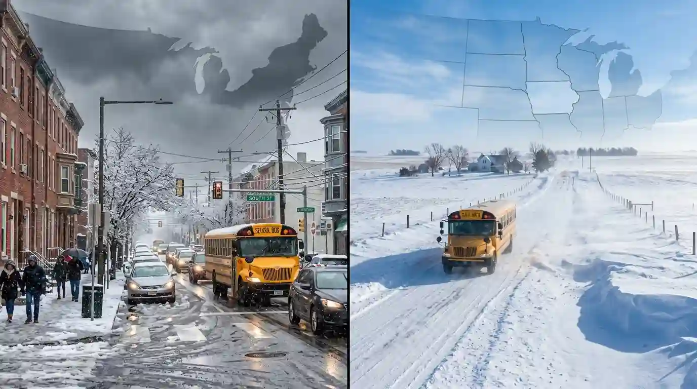
On the East Coast, many cities and suburbs are tightly packed. Roads are busy, school districts are close together, and morning traffic can become chaotic quickly. A few inches of snow during rush hour can create gridlock because there is less room for slowdowns, accidents, double-parked vehicles, and plows. In dense areas, the timing of the storm may matter more than the total amount.
In the Midwest, snowfall may be more familiar, but the region faces other hazards. Wide-open rural roads can become dangerous when wind blows snow across highways. Visibility can drop suddenly. Temperatures may fall far below freezing and keep roads icy for longer. Some districts cover large geographic areas, meaning a school bus may travel through very different conditions from one part of the district to another.
In short, East Coast snow days often depend heavily on precipitation type, timing, and congestion. Midwest snow days often depend heavily on cold, wind, drifting snow, and transportation distance. Both regions take snow seriously, but they are solving different safety equations.
The Weather Pattern Difference: Nor’easters vs Clippers and Lake-Effect Snow
Weather systems are a major reason snow day math changes by region. East Coast and Midwest storms often form in different ways, move differently, and create different school closure risks.
East Coast Nor’easters
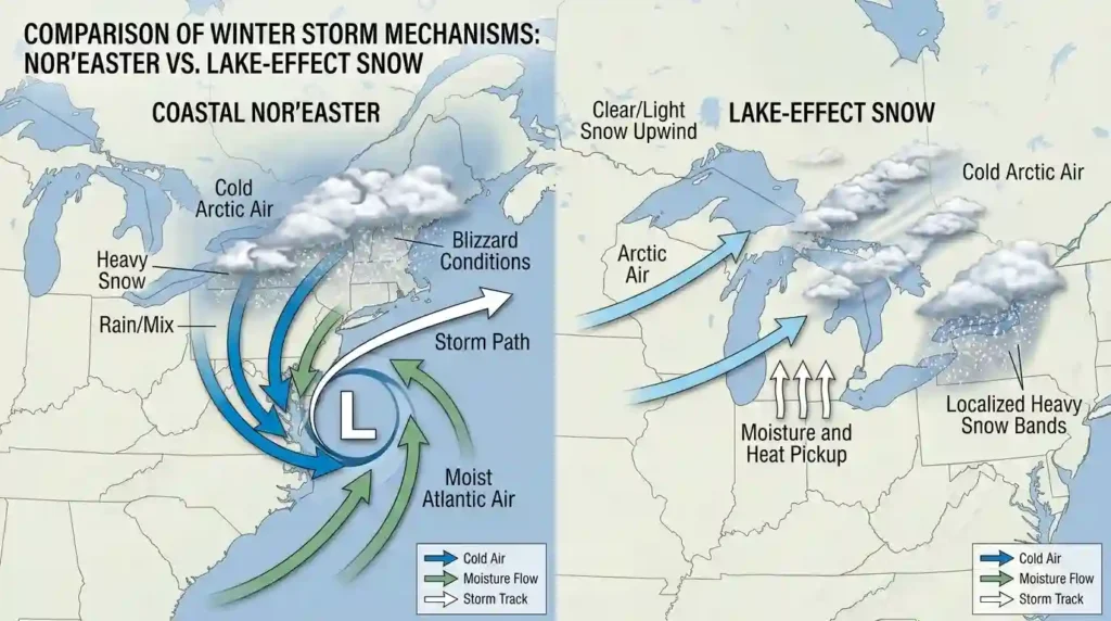
A nor’easter is one of the most powerful winter storm setups for the East Coast. These storms can develop along the Atlantic coast and bring heavy snow, strong winds, coastal flooding, and mixed precipitation. They are especially important for cities such as Boston, New York City, Philadelphia, Baltimore, and Washington, D.C.
Nor’easters can be difficult for school officials because small shifts in storm track may change the outcome dramatically. A district may expect snow, then receive sleet. Another area just 30 miles away may receive heavy snow. Coastal regions may mix with rain while inland suburbs get several inches of accumulation.
This uncertainty makes decision-making harder. If a district waits too long, families may not have enough time to plan. If it closes too early and the storm shifts away, parents may feel the decision was unnecessary. That balance is a major part of East Coast snow day forecasting.
Midwest Alberta Clippers
The Midwest often sees Alberta clippers, which are fast-moving systems that usually bring light to moderate snow, gusty winds, and colder air. These storms may not always produce blockbuster snowfall totals, but they can still create hazardous road conditions. A few inches of dry snow combined with wind can cause blowing snow, reduced visibility, and slick morning roads.
Because clippers move quickly, school districts often focus on timing. If snow falls overnight and ends before road crews can clear rural routes, a delay may be enough. If snow falls during the morning commute, cancellation becomes more likely.
Lake-Effect Snow
Lake-effect snow is one of the biggest Midwest winter variables, especially near the Great Lakes. Areas downwind of Lake Michigan, Lake Erie, Lake Ontario, Lake Superior, and Lake Huron can receive intense snowfall while nearby towns see much less.
Lake-effect snow bands are narrow but powerful. One school district may receive several inches in a few hours, while another district nearby gets only flurries. This creates a difficult problem: regional forecasts may not reflect hyperlocal snow amounts. School officials must consider radar trends, road reports, and local emergency management updates.
Lake-effect snow can also continue for long periods, making cleanup difficult. Even if the main roads are treated, side roads and bus stops may remain unsafe.
Snowfall Totals Are Only One Part of the Formula
Many students and parents focus on snowfall totals because inches are easy to understand. But school districts rarely make closure decisions based on snow depth alone.
A 3-inch snowfall can be more disruptive than an 8-inch snowfall if it arrives at the wrong time, includes ice, or falls on untreated roads. A 10-inch snowfall may be manageable if it occurs on a weekend, temperatures are moderate, plows have enough time, and the snow is light and powdery.
Wet Snow vs Dry Snow
East Coast storms often produce wetter, heavier snow, especially near the coast. Wet snow sticks to trees, power lines, sidewalks, and untreated roads. It is harder to shovel and more difficult for plows to move. It can also create power outage risks.
The Midwest often experiences colder, drier snow. Dry snow can be easier to plow, but it blows around more easily. This matters because drifting snow can refill roads after plows pass through. A road may be cleared at 5 a.m. and covered again by 6:30 a.m. if winds are strong.
Accumulation Rate
Snowfall rate is also important. One inch per hour during the morning commute is much more disruptive than one inch spread across six hours. Heavy snow can overwhelm road crews, reduce visibility, and make bus routes unsafe.
A school district may remain open for a slow 4-inch snow event but close for a fast 3-inch burst if it hits during bus pickup.
Temperature Before and After the Storm
Road temperature matters. If roads are warm before the storm, snow may melt at first. If roads are below freezing, snow can stick immediately. If temperatures crash after rain or wet snow, roads may freeze quickly.
This is common in both regions, but the Midwest often experiences sharper cold after storms. East Coast storms, especially near the coast, may hover near freezing, causing repeated melting and refreezing.
Road Treatment, Plowing Capacity, and Urban Density
Infrastructure changes the snow day equation. A city or town that has enough salt trucks, plows, and experienced crews can handle snow more effectively than a region where winter storms are less frequent.
East Coast Urban and Suburban Challenges
On the East Coast, snow removal is complicated by population density. Cars line streets. Traffic is heavy. Roads are narrow in older towns and cities. Sidewalks, bridges, tunnels, and public transit routes all need attention.
Even when main roads are plowed, school buses may still need to travel through side streets, apartment complexes, steep roads, and tight neighborhoods. In cities, snow piles can block visibility at intersections and make pedestrian crossings unsafe.
This means the East Coast snow day formula often includes more than road surface conditions. Districts may also consider whether students can safely walk, whether buses can turn around, whether staff can commute, and whether dismissal would create traffic problems.
Midwest Road Distance and Exposure
In the Midwest, roads may be wider and snow removal systems may be highly experienced. But distance creates a different challenge. Rural districts may cover large areas with long bus routes. A bus may travel on paved highways, gravel roads, open farmland routes, and shaded back roads in a single morning.
Open terrain also allows wind to move snow freely. A road may look clear in town but become dangerous outside town limits. This makes rural visibility and drifting snow major factors in Midwest snow day decisions.
Bridges, Hills, and Secondary Roads
Both regions must consider problem spots. Bridges freeze earlier than regular roads. Hills can become dangerous when buses need to stop and start. Secondary roads may not be cleared as quickly as main roads.
A district cannot base its decision only on the best-maintained road in the area. It must think about the most vulnerable parts of the transportation network.
School Bus Routes and Morning Commute Pressure
School buses are central to snow day decisions. Even if some parents can drive safely, buses must carry many students across the district on a strict schedule.
Why Bus Safety Matters So Much
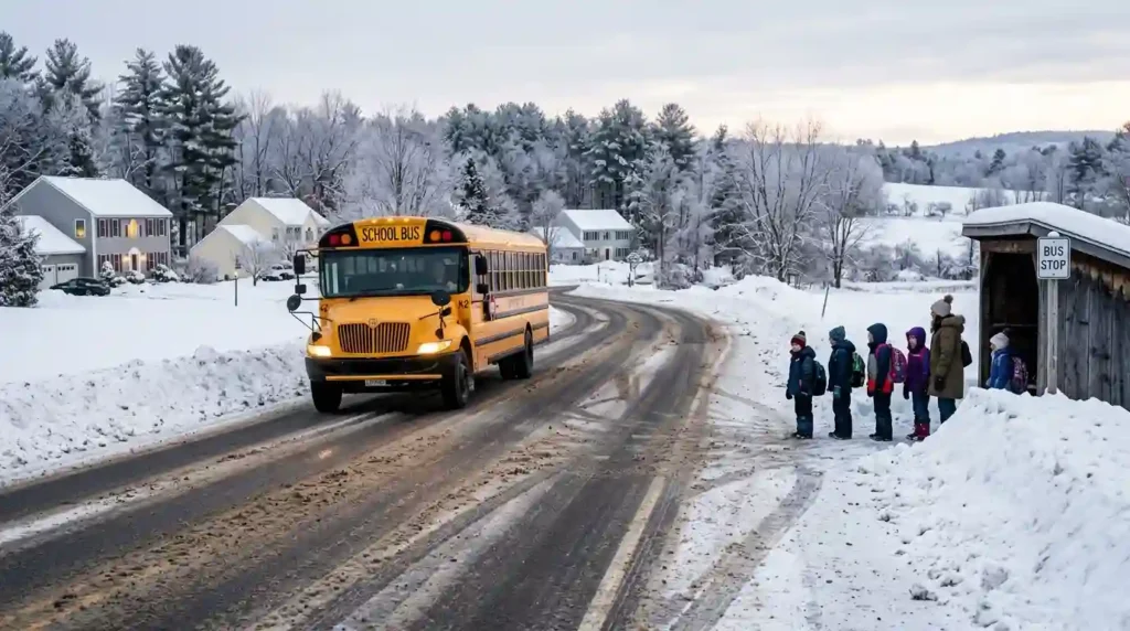
A school bus is large, heavy, and slower to stop on icy roads. It must pick up children near intersections, rural driveways, apartment complexes, and neighborhood streets. If visibility is low or roads are slick, the risk increases.
Bus stops are also part of the equation. Children may need to stand in extreme cold, cross snow-covered roads, or wait near plowed snowbanks. A district may close not only because buses cannot drive, but because children cannot safely wait outside.
East Coast Commute Timing
The East Coast has intense commuter traffic. School buses often share roads with office commuters, delivery trucks, public transit vehicles, and ride-share traffic. When snow begins during the early morning, conditions can deteriorate quickly.
Even a small storm can become high-impact if it starts at 6 a.m. A district may choose cancellation instead of risking buses getting stuck in rush-hour congestion.
Midwest Route Length
In the Midwest, some districts have long bus routes through rural areas. A student may live far from school, and road conditions may vary widely across the district. Wind chill and drifting snow can make these routes risky even when snowfall totals are not extreme.
This is why Midwest districts may close for wind and visibility concerns even when the snow amount seems manageable.
Ice, Sleet, and Freezing Rain: The East Coast Wild Card
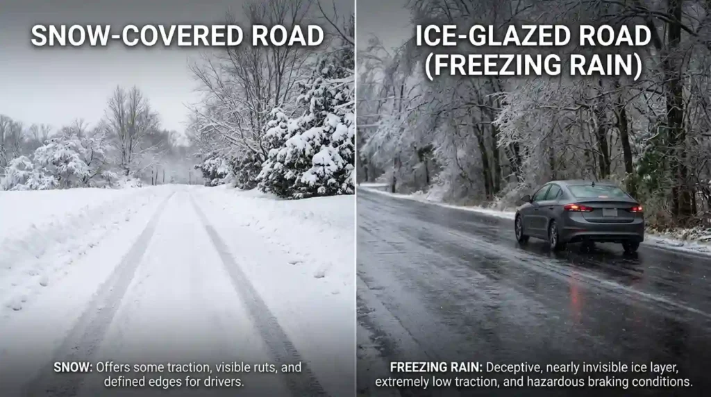
One of the biggest East Coast snow day variables is mixed precipitation. The East Coast often sits near the battle line between cold inland air and warmer Atlantic air. This creates snow, sleet, freezing rain, and rain within the same storm.
Why Ice Can Matter More Than Snow
Ice is often more dangerous than snow because it reduces traction dramatically. A small glaze can make sidewalks, parking lots, bus steps, and roads unsafe. Freezing rain can also bring down trees and power lines, creating outages and blocked roads.
School districts may close for a storm that produces little snow if freezing rain is expected during arrival or dismissal.
The Rain-Snow Line Problem
East Coast forecasts often depend on the rain-snow line. A small temperature difference can change a forecast from 6 inches of snow to 1 inch of sleet and freezing rain. This makes decisions difficult because precipitation type may change hour by hour.
For example, a school district near Philadelphia, New York City, or coastal Connecticut may see snow at first, then sleet, then freezing rain, then rain. Inland suburbs may stay all snow. Coastal communities may mostly rain. The school closure decision depends on which version of the storm actually reaches the district.
Icy Dismissal Risk
A storm that begins as rain in the morning and freezes by afternoon can be especially dangerous. Schools may open under wet conditions but face icy roads by dismissal. Many districts prefer to avoid situations where students arrive safely but cannot get home safely.
This is why school officials do not only ask, “Can we open?” They also ask, “Can we dismiss safely later?”
Wind Chill, Blowing Snow, and Rural Visibility in the Midwest
The Midwest snow day formula often gives more weight to wind chill, blowing snow, and visibility. These factors can turn a moderate snow event into a serious travel hazard.
Wind Chill and Student Safety
Wind chill is a major concern in states such as Minnesota, Wisconsin, Iowa, Illinois, Michigan, North Dakota, South Dakota, Nebraska, and Ohio. Even if roads are passable, dangerously cold air can make it unsafe for students to wait outside for buses.
Extreme cold can also create mechanical issues. Buses may struggle to start. Diesel engines may need extra preparation. Heating systems must work properly. Schools may consider whether buildings can maintain safe indoor temperatures.
Blowing and Drifting Snow
Dry snow and strong wind create blowing snow. This can reduce visibility, cover roads after plowing, and create drifts. In rural Midwest areas, open fields allow snow to blow across roads with few barriers.
A district may cancel because road crews cannot keep roads clear, not because snow is still falling heavily. This is a key difference from some East Coast events, where urban congestion and mixed precipitation may be bigger concerns.
Ground Blizzards
A ground blizzard happens when snow already on the ground is lifted by strong winds, causing whiteout-like conditions even when little or no new snow is falling. This is especially relevant in open Midwest landscapes.
From a school safety perspective, a ground blizzard can be just as disruptive as an active snowstorm. Buses need visibility, and drivers need clear road edges. If blowing snow hides lane markings or causes sudden whiteouts, closing school may be the safest choice.
East Coast Snow Days vs Midwest Snow Days: How Local Expectations Change the Math
Another important part of East Coast Snow Days vs Midwest Snow Days is community expectation. Snow day decisions are influenced not only by weather but also by what local families, road crews, and schools are prepared to handle.
What Is “Normal” Snow?
In many Midwest communities, snow is a regular part of winter. Plows, salt supplies, winter tires, and snow-driving experience are common. Schools may be less likely to close for smaller snowfalls because communities are built around winter readiness.
On parts of the East Coast, especially in major cities and coastal regions, snow may be frequent but still disruptive because of density and mixed precipitation. In the Mid-Atlantic, where storms may be less consistent than in New England, the same amount of snow can have a bigger impact.
Normal is local. A snowfall that feels routine in Grand Rapids may feel disruptive in Washington, D.C. A storm that Boston can handle with preparation may create bigger issues in areas that sit closer to the rain-snow boundary.
Parent and Staff Logistics
Schools also consider family logistics. If a storm is expected, parents need time to arrange childcare. Teachers and staff need to travel. Food service, maintenance teams, custodians, and administrators must reach buildings safely.
In high-density East Coast metro areas, staff may commute from multiple counties or states. In the Midwest, staff may travel long distances across rural roads. Both situations create different risks.
Remote Learning and Flexible Days
The rise of remote learning has also changed snow day math. Some districts now use virtual learning days instead of full closures. Others preserve traditional snow days because they believe students need a break, internet access is unequal, or younger children cannot learn effectively online during emergencies.
This means two districts facing the same storm may make different decisions based on policy, technology access, and state attendance rules.
How Snow Day Calculators Estimate Closure Chances
A snow day calculator or predictor uses weather and local conditions to estimate the chance of school closing. While no tool can guarantee a district decision, a good model considers more than snowfall.
If you want to estimate your local closure chance, try the Snow Day Predictor. It can help users think beyond inches of snow and consider timing, temperature, and regional winter patterns.
Important Factors a Predictor Should Consider
A strong snow day prediction model may include:
- Forecast snowfall amount
- Snowfall timing
- Ice or freezing rain risk
- Temperature before and after the storm
- Wind speed and wind chill
- Road treatment capacity
- Urban vs rural transportation patterns
- Local school district history
- Bus route difficulty
- Whether the storm affects arrival or dismissal
- Forecast confidence
These factors matter because snow day decisions are impact-based. A district does not close simply because snow exists. It closes when the snow, ice, cold, or wind creates a safety problem that cannot be managed in time.
Why Regional Data Improves Accuracy
Regional data makes predictions more realistic. A Midwest district may need stronger wind-chill weighting. An East Coast district may need stronger ice and commute-timing weighting. A Great Lakes district may need lake-effect snow probability. A coastal district may need rain-snow line uncertainty.
This is why a national snow day formula can be useful, but a regional snow day formula is better.
Avoiding Common Snow Day Prediction Mistakes
Many people assume that one snowfall number always means school will close. That is one of the biggest misconceptions. For a deeper breakdown of common errors, read 5 Myths About Snow Day Predictions Debunked.
Snow day predictions are not just about excitement. They are about safety, transportation, and local decision-making. The more factors you understand, the easier it becomes to see why your district made a certain call.
What Changes the Math Most: A Side-by-Side Comparison
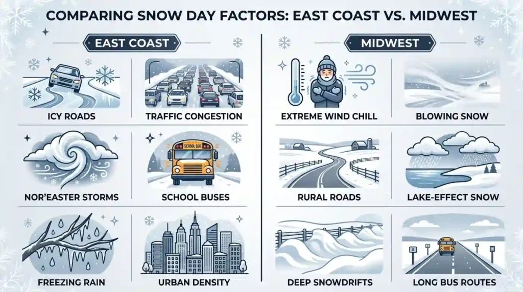
East Coast Snow Day Factors
East Coast snow day decisions often become more likely when:
- Snow begins during morning rush hour
- Freezing rain or sleet is expected
- Roads are narrow, crowded, or untreated
- Sidewalks and bus stops become icy
- Forecast confidence is low but risk is high
- A nor’easter may intensify quickly
- Dismissal could happen during the worst conditions
- Public transit and staff commutes are disrupted
- Heavy wet snow creates power outage risks
The East Coast formula is often about timing, precipitation type, traffic density, and uncertainty.
Midwest Snow Day Factors
Midwest snow day decisions often become more likely when:
- Wind chills become dangerous
- Blowing snow reduces visibility
- Rural roads drift over after plowing
- Lake-effect snow bands set up over the district
- Bus routes are long and exposed
- Temperatures remain below freezing for long periods
- A clipper brings snow during arrival time
- Ground blizzard conditions develop
- Road crews cannot keep up with drifting
The Midwest formula is often about cold, wind, visibility, route distance, and persistent road hazards.
Same Snow, Different Outcome
Imagine two districts both expecting 4 inches of snow.
An East Coast district may close if the snow starts at 5:30 a.m., mixes with freezing rain, and falls during heavy commuter traffic. The issue is not just 4 inches. It is ice, timing, congestion, and safe arrival.
A Midwest district may stay open for 4 inches if it falls overnight, roads are cleared, winds are light, and temperatures are manageable. But that same Midwest district may close for only 2 inches if strong winds create drifting snow and wind chills become dangerous.
That is the real answer: the snowfall number is only one variable. The local impact is what changes the math.
Conclusion
East Coast and Midwest snow days may look similar on a school calendar, but the decision math behind them is very different. The East Coast often deals with nor’easters, mixed precipitation, freezing rain, crowded roads, dense neighborhoods, and high-pressure commute timing. The Midwest often deals with colder temperatures, lake-effect snow, Alberta clippers, blowing snow, rural bus routes, ground blizzards, and dangerous wind chills.
The biggest lesson is that snowfall totals do not tell the whole story. A snow day decision is really an impact decision. School officials must ask whether students, buses, staff, and families can move safely before, during, and after the school day.
That is why 3 inches can close school in one place while 8 inches may not close school somewhere else. The storm’s timing, temperature, wind, ice risk, road conditions, and local preparedness all change the formula.
Understanding East Coast Snow Days vs Midwest Snow Days helps parents, students, and teachers make better sense of winter forecasts. Instead of asking only, “How many inches are coming?” it is smarter to ask, “What kind of storm is this, when will it hit, and how will it affect our local roads and buses?”
FAQs
1. Why do East Coast schools close for less snow than some Midwest schools?
East Coast schools may close for lower snowfall amounts because dense traffic, narrow roads, mixed precipitation, freezing rain, and rush-hour timing can make even a small storm dangerous. Midwest schools may be more prepared for regular snow, but they still close when wind chill, drifting snow, or visibility becomes unsafe.
2. Are Midwest snow days harder to get?
In some areas, yes. Many Midwest communities are used to frequent snow and have strong plowing systems. However, Midwest districts may close quickly for extreme cold, blowing snow, rural road drifting, or lake-effect snow bands. Snow days are not only about snow totals.
3. Why does freezing rain cause school closures?
Freezing rain creates a layer of ice on roads, sidewalks, parking lots, bus steps, and trees. Even a small amount of ice can make travel and walking dangerous. It can also cause power outages by weighing down trees and power lines.
4. What matters more for snow days: inches of snow or timing?
Timing often matters more. Snow that falls during the morning commute or afternoon dismissal can be more disruptive than heavier snow that falls overnight. Schools need safe arrival and safe dismissal, not just manageable snowfall totals.
5. Why do nearby school districts make different snow day decisions?
Nearby districts may have different road conditions, bus routes, elevation, snow amounts, staffing patterns, and local policies. One district may include rural roads while another is mostly urban. A small geographic difference can change the risk.
6. How does wind chill affect Midwest snow day decisions?
Wind chill affects whether students can safely wait outside for buses or walk to school. In extreme cold, exposed skin can become dangerous quickly. Midwest districts often treat wind chill as a major safety factor even when snowfall is light.
7. What is lake-effect snow, and why does it matter?
Lake-effect snow forms when cold air moves over relatively warmer lake water, picking up moisture and dropping snow downwind. It matters because it can create narrow, intense snow bands. One town may get heavy snow while another nearby town gets very little.
8. Can a snow day predictor guarantee school closures?
No snow day predictor can guarantee a closure because school decisions depend on local judgment, district policy, road reports, and forecast changes. However, a predictor can estimate probability by considering snow, ice, temperature, wind, timing, and local patterns.